This is a fantastic website for being able to access maps from different times and to be able to see field names from the tithe maps: https://www.somersetheritage.org.uk
A number of old maps of the village exist and can be accessed below:
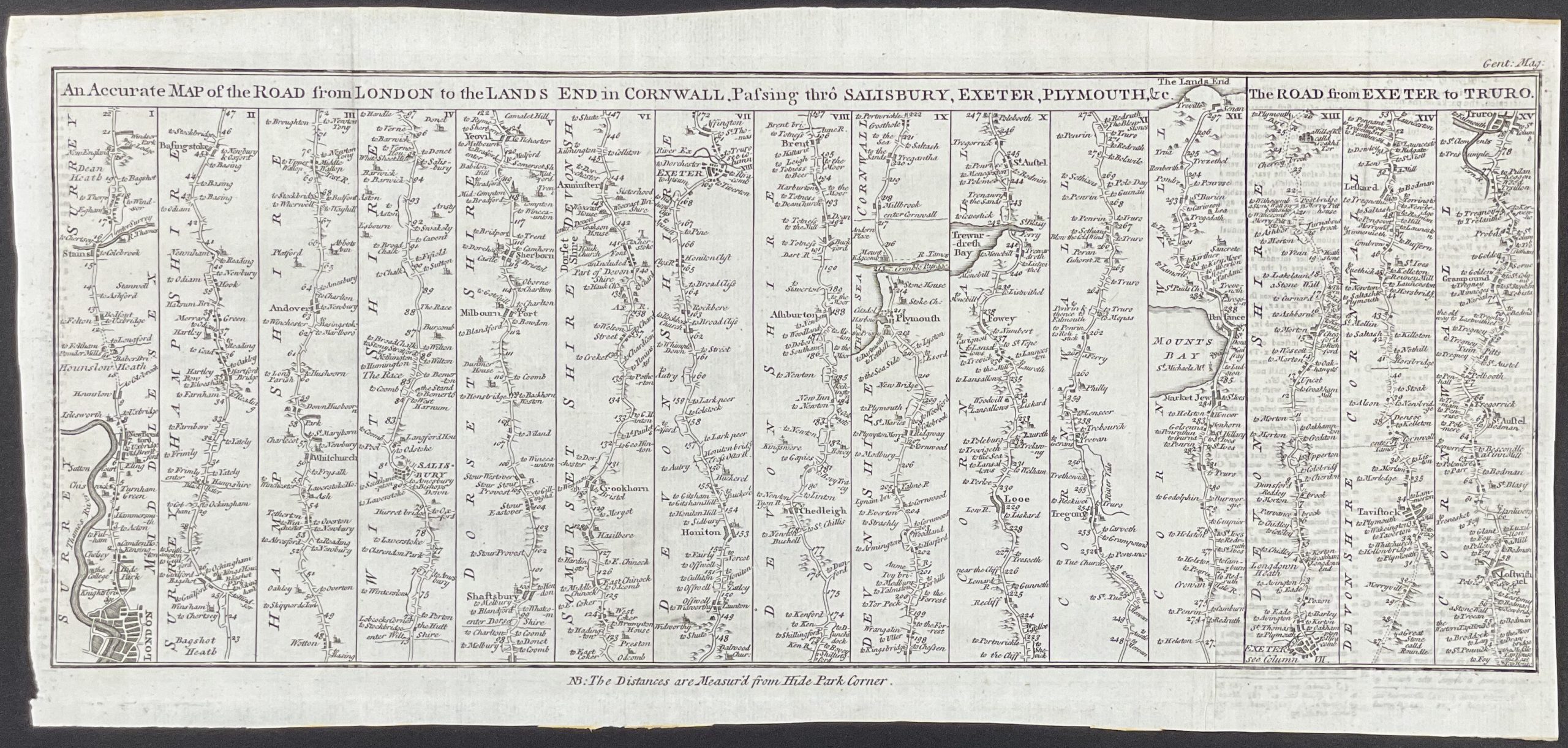
1731 Ribbon map showing route from London to Land’s End
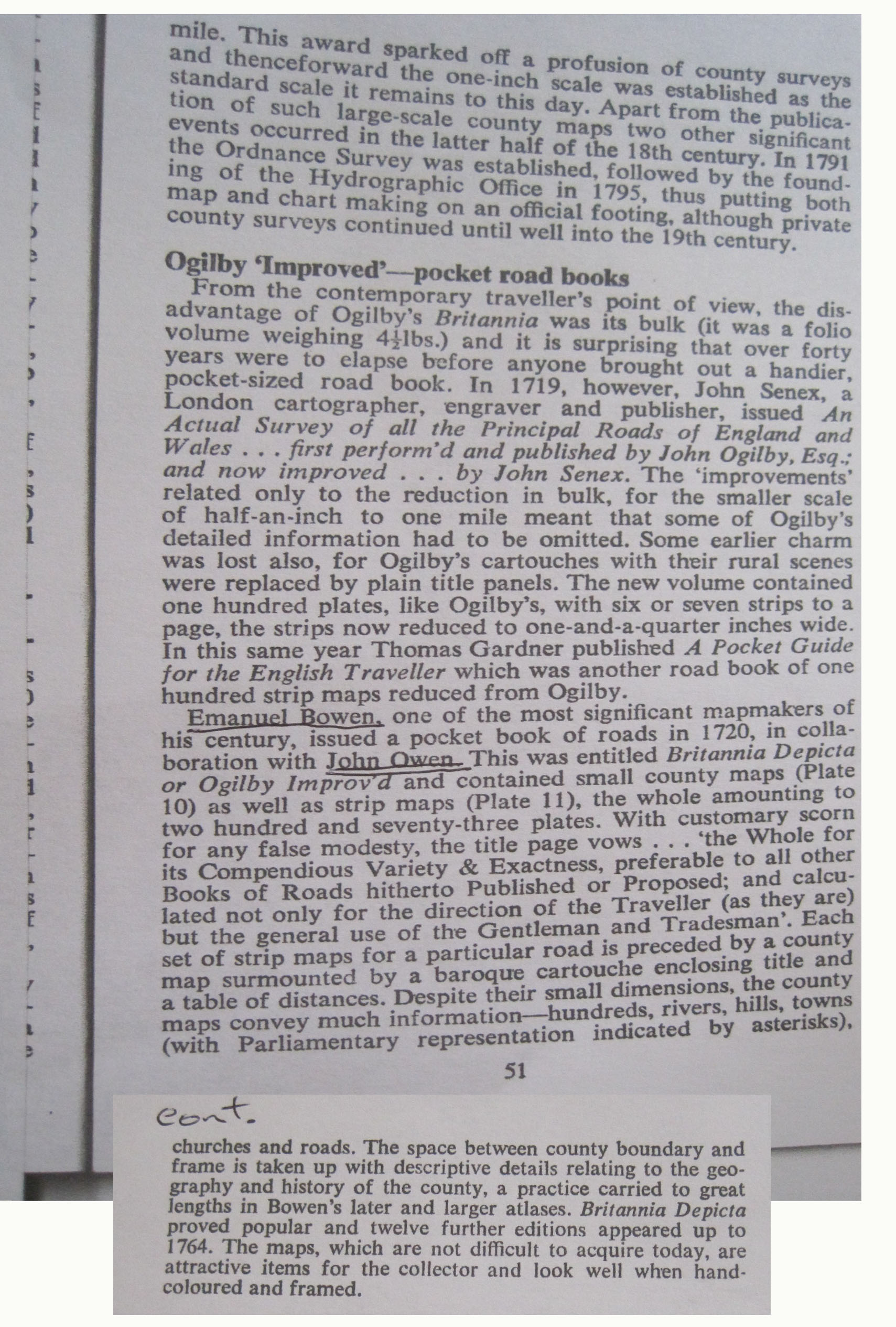
1753 Ribbon map showing Milborne Port section
Information about the 1753 ribbon map
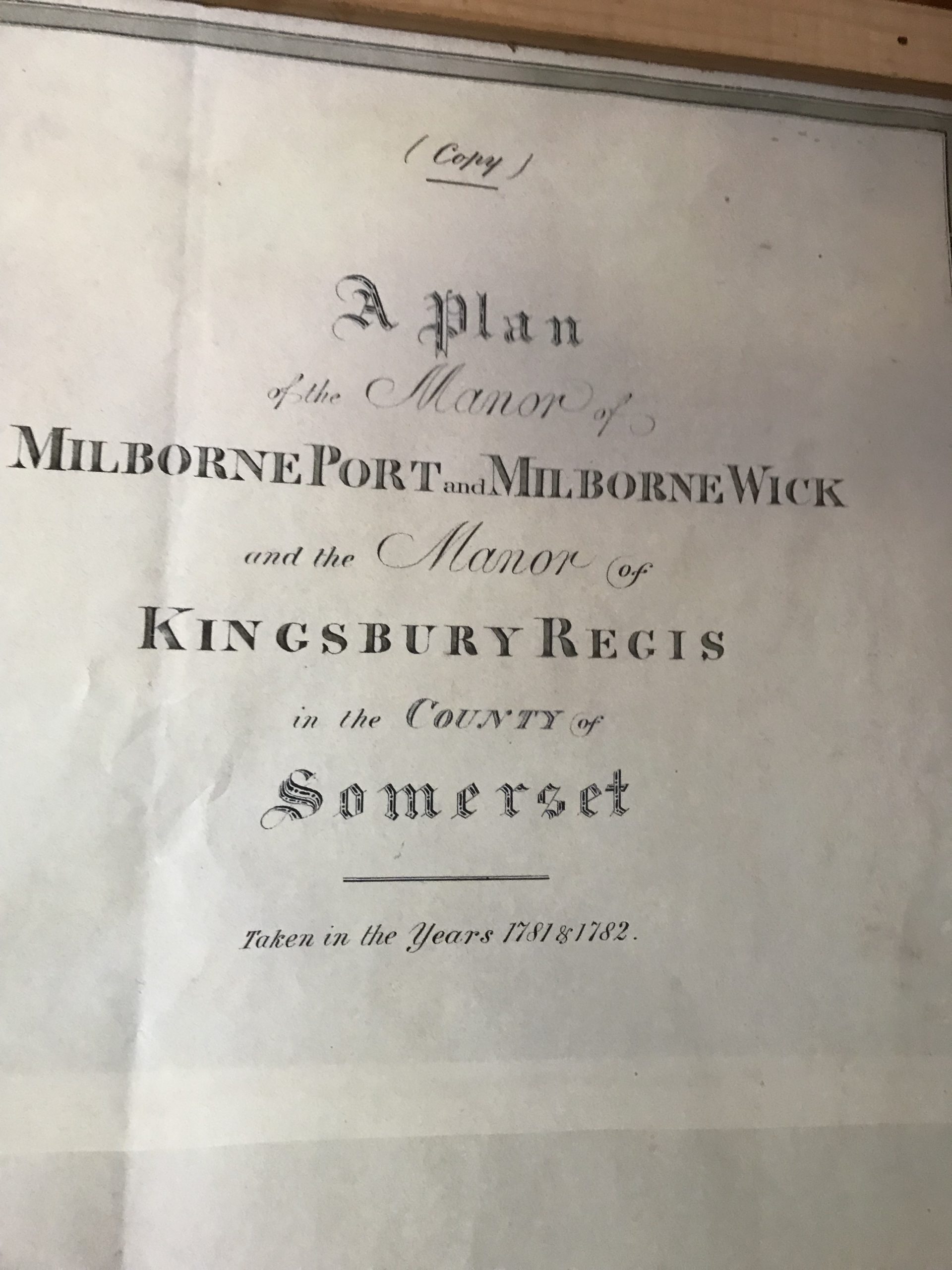
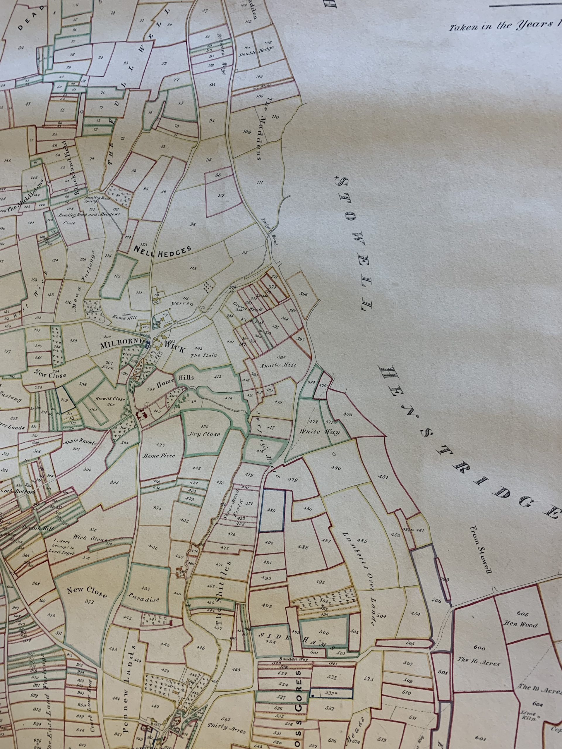
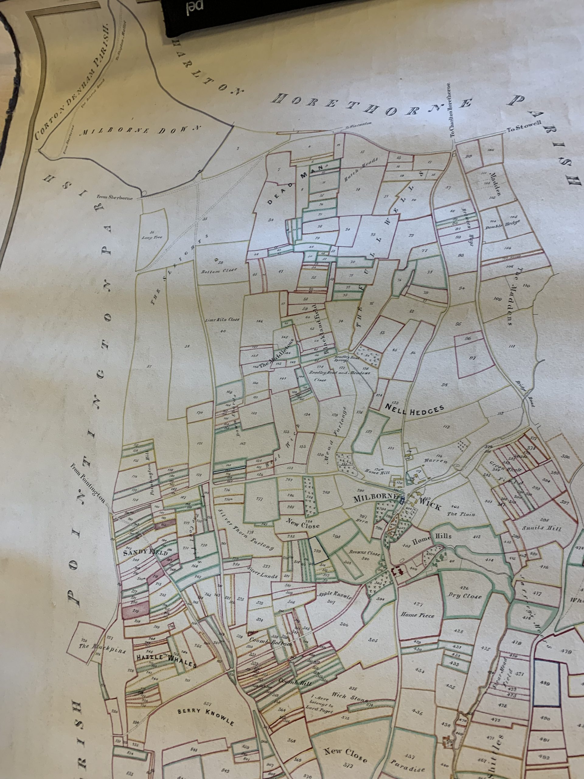
1781 and 1782 map
1781 & 1782 – title page
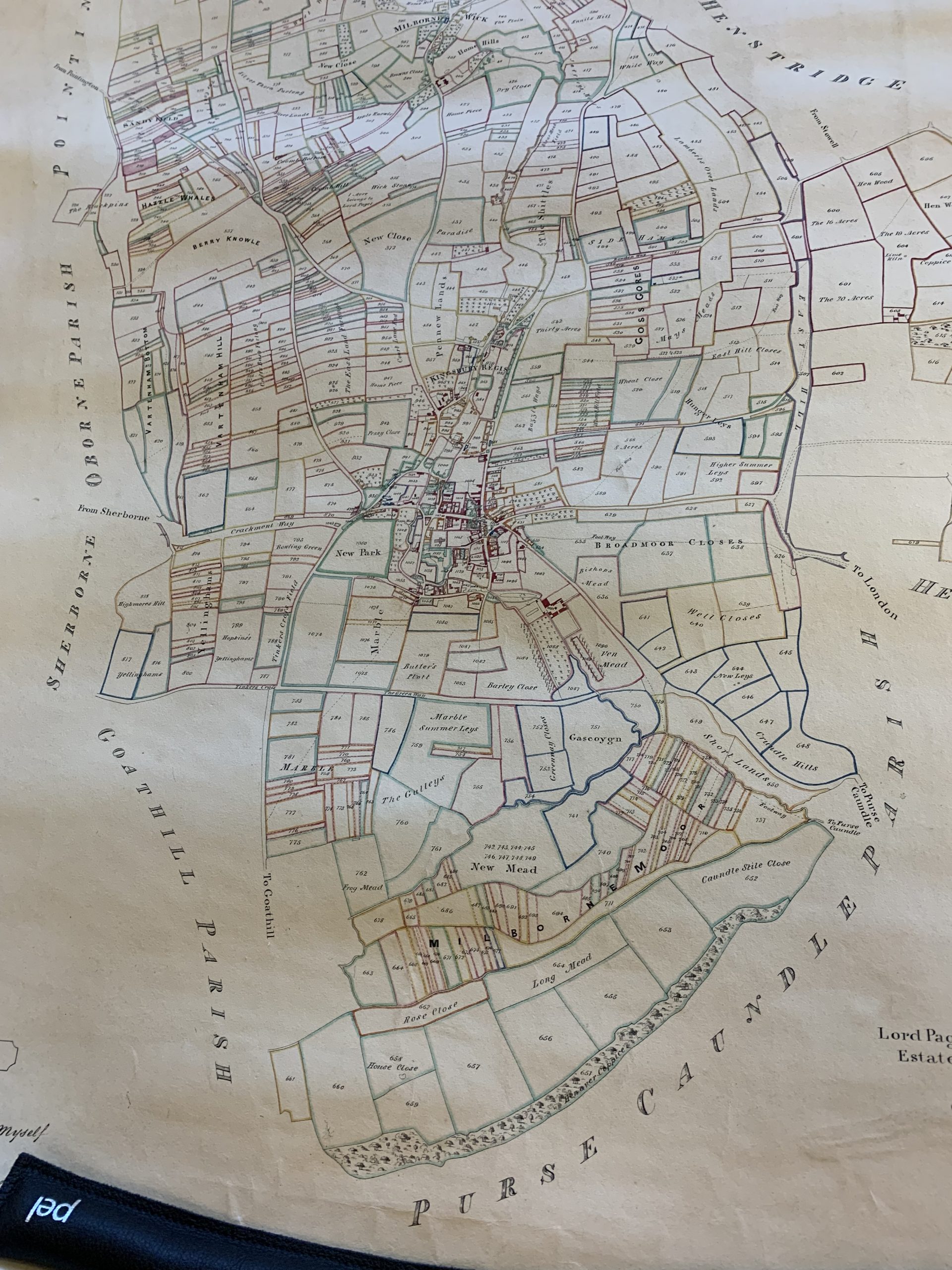
overview 1
overview 2
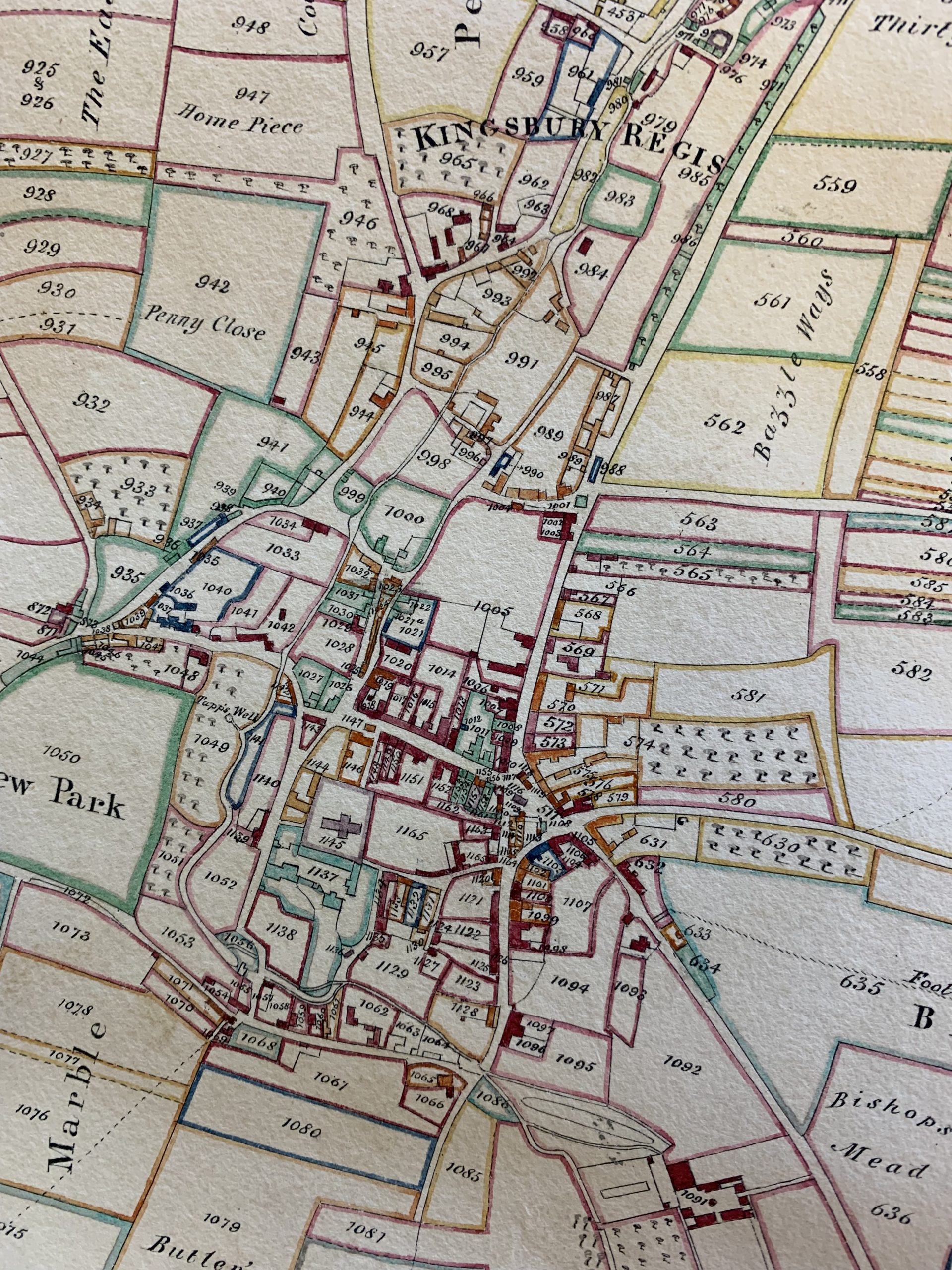
central part of the village
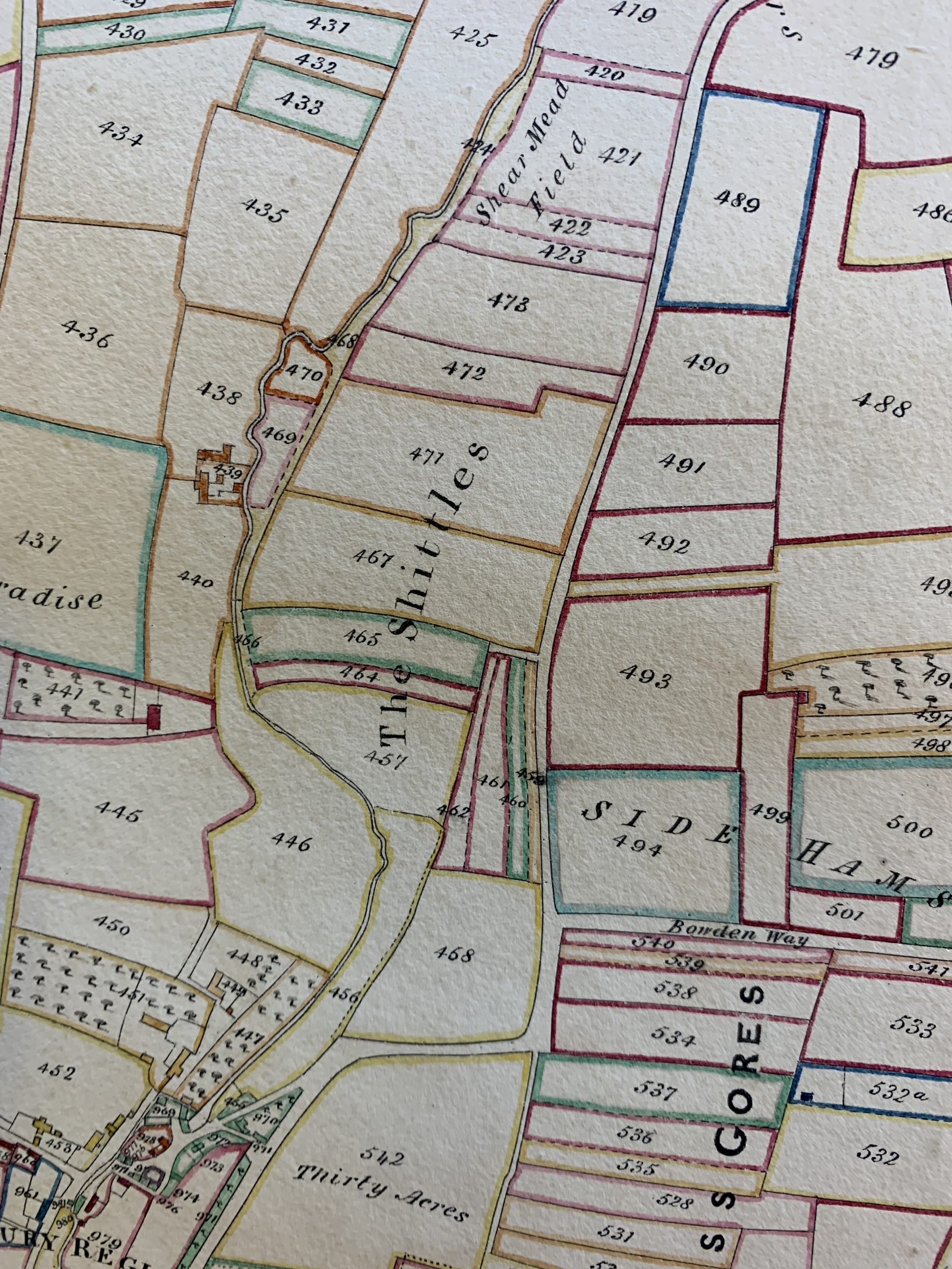
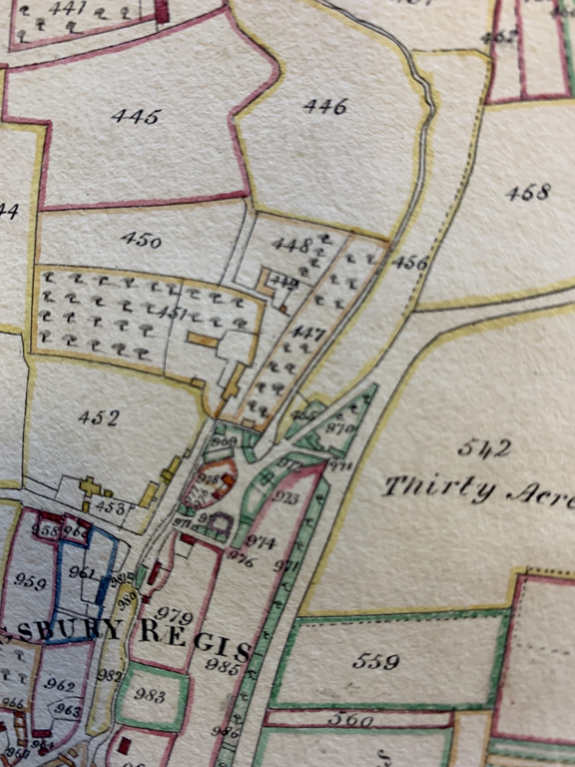
north of Kingsbury
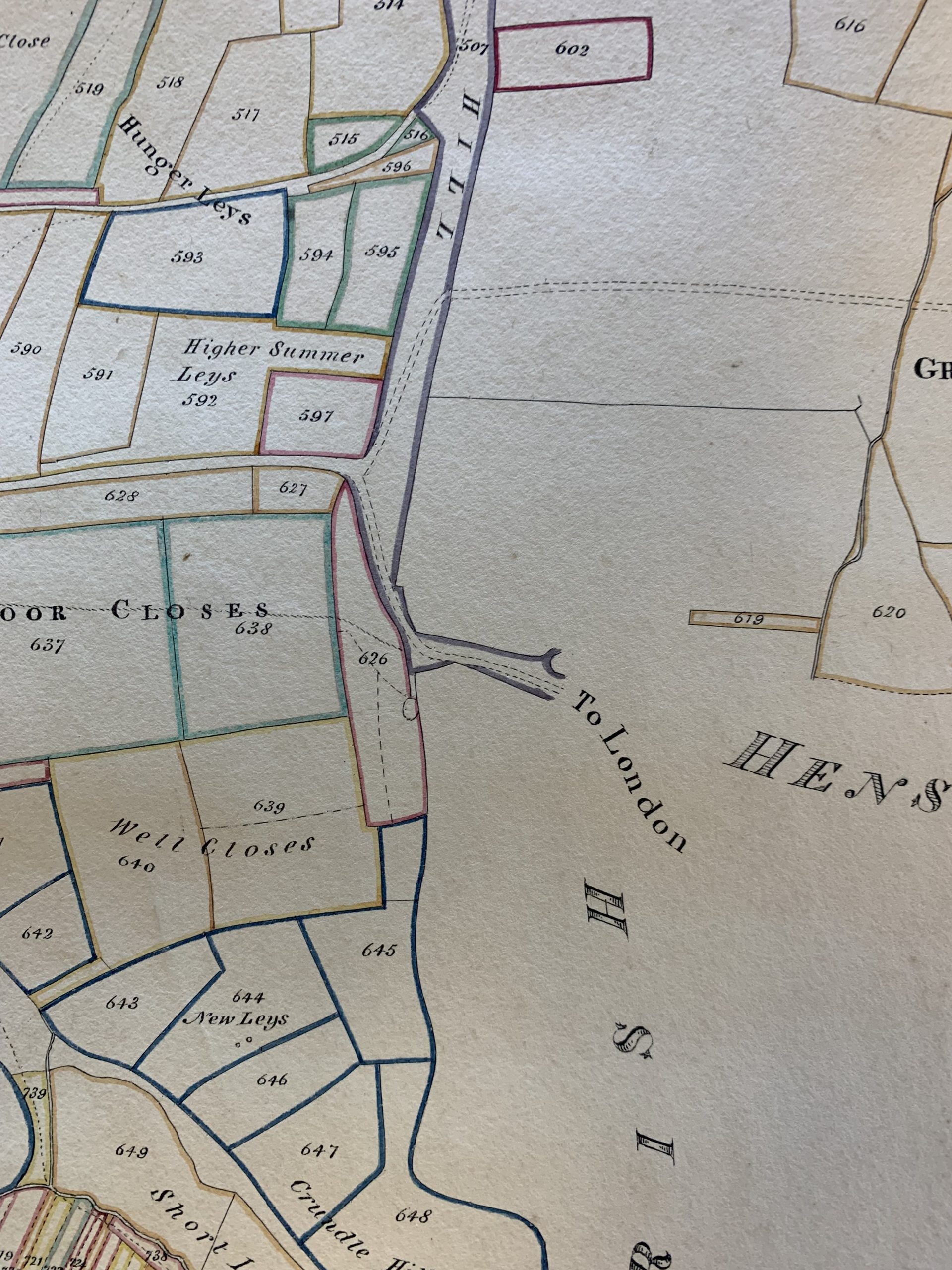
east of Kingsbury
east Milborne Port
north east of Milborne Port
north west of Milborne Port
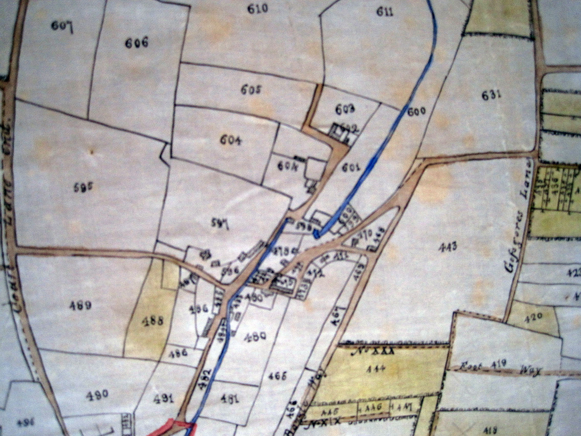
1839 Tithe map – Lower Kingsbury area
Website address for late 19th century online map with modern equivalent ‘side-by-side’:
https://maps.nls.uk/geo/explore/side-by-side/?fbclid=IwAR2eJska5UolgY6XrRCLUlKyIZC5b46szyPSW7IASCUyUqCcWyr1MnM_R38#zoom=17.810000000000002&lat=50.97223&lon=-2.46336&layers=178&right=ESRIWorld